Showing posts with label chumash indians. Show all posts

Thursday, February 13, 2014

Of Missions, Meat & Movies: Mission San Luis Obispo


Mission San Luis Obispo de Tolosa was named after Saint Louis (no, not the city) who was the Bishop of Toulouse in France and was founded in 1769. Let’s stop there. “Founded” merely meant a prayer was said, a cross stuck into the ground and that was pretty much it. The Spanish who controlled California used the chain of missions to not only bring religion to the New World, but the missions acted as trading posts in the once rugged and desolate California landscape.


But hang on. Why here exactly? On September 7 and 8, 1769 Gaspar de Portola and his expedition traveled through San Luis Obispo on their way to the Monterey Bay. The expedition’s diarist, Padre Juan Crespi, recorded the name given to this area by the soldiers as “llano de los Osos” or the “bear plain,” as there used to be a whole hell of a lotta bears here. In fact, Los Osos, just west of San Luis Obispo, still holds that name.
 
Father Serra and the SLO Mission
Skip forward to 1770 and Father Serra founded Mission San Carlos Borremeo in Monterey (it was moved to Carmel the following year.) As the Monterey mission’s supplies dwindled in 1772 soldiers, padres and Native Indians faced starvation. Remembering the bear plain where they had stuck a cross into the dry earth years before, a hunting expedition was sent to San Luis Obispo to bring back food in the summer of 1772. Over 25 mule loads of bear meat was sent up coast to the Carmel Mission. It was after this that Father Serra decided that San Luis Obispo would be the ideal place for a fifth mission. The region had abundant supplies of food and water, the climate was mild, and the local Chumash were very friendly, until, you know, they were enslaved. Given these conditions, Father Serra set out on a journey to reach the bear plain and on September 1, 1772, he celebrated the first mass near San Luis Creek.

After Father Serra left, the task of building the mission remained which was accomplished primarily by the hard work of the local Chumash Indians – as in cheap labor. The church and priest's residence were built by 1794, and other structures made up the primitive mission in the early days, namely storerooms, residences for single women called a “monjerio,” barracks and a few
A photo of a photo, but historically cool
mills. The mission also used the land for farming and raising livestock since all missions depended upon whatever they produced for their survival. Expansion proceeded for a few years due to the prosperity of the mission, but those days were numbered and Mission San Luis, like all the other missions, gradually fell into disrepair in part because Spain stopped sending money to fund the California missions. When Mexico won independence from Spain in 1821 the missions were “secularized,” decommissioned as it were, and often mission lands were sold off. Governor Pio Pico sold the San Luis Obispo Mission to Captain John Wilson for a mere $510 in 1845, about $15,500 in today’s dollars, still a seal (though the actual church was not included in the deal). The building served multiple functions, even as a jail and the first county courthouse. It was returned to the Catholic Church in 1859.
Still an active church the mission is open daily

Today the mission fronts Mission Square (where parts of the Sandra Bullock film, Murder by Numbers was shot – no pun intended) facing the creek, and Higuera St. The courtyard is a popular place for small gatherings and festivals. The 
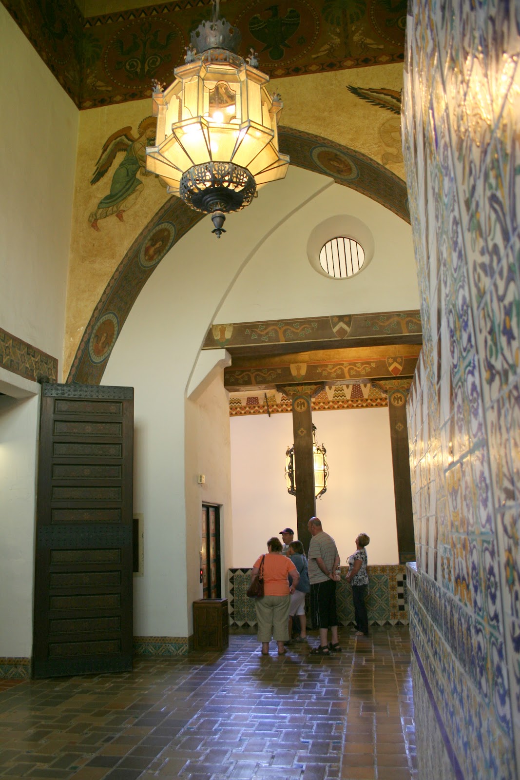
interior of the mission is minimally decorated, mainly hand painted. The whitewashed interior walls of the church are enlivened by a brilliantly hued “vine of life,” a reproduction of the original decor. The original floors were packed earth back in the day, colored red with cinnabar. Now of course it’s colored concrete. Still an active church, mass is held each day at 7 a.m.


A visit to the mission museum will set you back $3, and it’s worth the cost. The original mission doors are located, ironically, inside the museum on display and were used up until 1948. The museum is surprisingly large but it’s not all mission era stuff on display here. There is a good number of Indian artifacts; bowls and baskets, jewelry, pottery arrowheads and abalone shell pottery. There are mission-era vestments the padres wore, church artifacts and early 19th century clothes and personal belongings once the Westerners moved in to this region There are quite a few adobe cut-outs so you can see the exposed brick. The outside gardens are intimate with a water-well located center overlooked by Madonna Mountain. Clearly modernized landscaping with little green lawns does not reflect what it actually would have looked like and the mission itself is surrounded by Australian Eucalyptus trees.
A lonely portion of one of the original walls

For you true history buffs, walk across the street to the historical society building and there, barely seen or known about is part of the original mission wall – just a small chunk of authentic history waiting for someone to notice it. (MISSION SAN LUIS OBISPO, 751 Palm St., San Luis Obispo, 805/781-8220)

Saturday, March 16, 2013

Arroyo Hondo Preserve: Hiking Through Time


I am not a botanist. Nor do I pretend to know much about native plants, habitat restoration, or land use regulation. Regardless I committed to a 10-week program of habitat restoration at the Arroyo Hondo Preserve along the Gaviota Coast; that stretch of sun baked coastal land which extends from Santa Barbara out to where Highway 101 turns inland. This 30 mile stretch is one of the last un-spoiled tracts of coastal land in California and is a multitude of agriculture pasture lands, canyons and pristine beaches.

At 782 acres the Arroyo Hondo canyon looks deceptively small. The earliest known inhabitants of Arroyo Hondo were the Barbareno-Chumash civilization going back about 5,000 years. When Spanish explorer Juan Rodriguez Cabrillo sailed through the Channel in 1542, his team recorded a camp of the Native Americans located here at the mouth of Arroyo Hondo creek. Just 227 years later when the De Anza expedition actually walked this area, the village at Arroyo Hondo was abandoned. Of course the arrival of the Spanish spelled doom for the Chumash, maybe they understood that.

Rancho Arroyo Hondo was part of the original 26,530-acre Rancho Nuestra Señora del Refugio Mexican land grant to former Santa Barbara Presidio Commandant Jose Francisco Ortega in 1827 – that’s quite a gift by today’s standards. Only three families have owned this land since the Chumash first inhabited it and the adobe house on the property was built in 1842 by the Ortega family and was used as a stagecoach stop on the route between Lompoc and Santa Barbara in the late 1800s and the old road (since there was no freeway or railroad crossing) passed by the adobe. There is a small museum inside, two rooms actually, mainly photos and a few scrapbooks providing some history. 

Undoubtedly because of the narrow canyon at Hondo and its streamlined views down to the road it became a refuge for outlaws including Joaquin Murrieta, known to have murdered at least one man (Murrieta was killed by a posse in 1853 at his headquarters near Coalinga), and Jack Powers who terrorized travelers after the gold rush. Therefore you have the aptly named and best hiking trail here- The Outlaw Trail which takes you from the mouth of the canyon far up into the mountain with killer views. The trail is really two parts, a low key stroll through Hollister meadow and a slight incline which stops at a small grass clearing. Housed there is a wood picnic table placed strategically so you can rest and enjoy ocean views. If this seems taxing, don’t bother with the rest of the trail. From here it ascends sharply into the mountains and you leave behind the lush meadow by the stream and as you ascend the vegetation becomes more sparse, low to the ground, the heat becomes more pronounced, and the land more unforgiving.
Views along the Outlaw Trail

Heading up the Outlaw Trail you pass through successive layers of rock formations, some estimated to be about 40 million years old. At the top are sweeping views and a cool malformed sandstone outcropping looking more like Swiss cheese with holes and tunnels permeating its core, where you can stand and feel like you own the whole world. The views to the Pacific and the Channel Islands are unsurpassed. It’s just you and the random hawks and turkey vultures who silently soar above you. To your left is the Tajiguas landfill (which one local paper described as the “prettiest and most expensive landfill” in the tri-counties) and the peculiar juxtaposition of two canyons, one a nature preserve and one a garbage dump, is amusing, if not a little sad. But then that’s exactly the point of keeping Arroyo Hondo in perpetuity. This canyon won’t end up being a dumping ground for our insatiable need to waste things.

Looking down the canyon from the top of Outlaw
During my 10 weeks at the preserve I weeded, hoed, planted “native” plants under the direction of botanist Darlene Chirman, weeded again, mulched, watered, and tediously weeded again. I was curious about restoration, after all, what are “native” species and how do you track a chronology of plants? The rule of thumb in California is that native plants refer to plants here prior to the arrival of the Spanish and the goal is to bring Hondo back to that close approximation. Once the Spanish came they began cultivating the land with seeds and cuttings from Spain and Mexico, forever altering the landscape. It seems futile in some regards to get back to that point in time, and certainly with ubiquitous weeds piercing through the ground and the constant effort to root them out, it’s a perplexing task. But if left unchecked, this preserve, along with the plants and animals like mountains lions, newts, birds and fish that have long called this place home, would suffer from a changing landscape forcing them to retreat elsewhere.
Volunteers doing their thing

Perhaps that is the obvious nature of evolution and we should not try and maintain a piece of land, memorializing it from its heyday. Perhaps evolution demands we let nature take its own course, and that’s a viable argument. But after 10 weeks here I realize that we humans are stewards of this planet and the animals and plants in it. The work that restoration volunteers do here may not stop nature from what She wants to accomplish, but they are helping to preserve Hondo as it was before Westerners came along. The hope is that this place of natural beauty and history will inspire others, and that, regardless of what might happen with building codes, zoning laws and property rights, this valuable section of the Gaviota Coast will remain unspoiled and available to everyone.


Hondo is open the first and third weekends of each month. There are free docent led hikes the first Saturday and third Sunday of every month at 10 a.m. There’s no cost to visit, but donations are gladly accepted. Advance reservations are required – simply do this on-line – as a way of knowing who comes out, in part because the gates get locked and you don’t want to be stuck here. From Santa Barbara north on Highway 101 Arroyo Hondo is four miles past Refugio State Beach. Look for the blue CalTrans call boxes spaced one mile apart on the right hand side of the highway. The Arroyo Hondo entrance is located immediately after call box 101-412.   ARROYO HONDO PRESERVE


Sunday, December 2, 2012

Monterey's Mission

The beautiful Carmel Mission

Monterey may be the bread basket of America (the Salinas Valley is one of the most fertile places in the country), and home to Cannery Row and the fantastic Monterey Bay Aquarium and neighbor to Carmel and Big Sur, but it’s also home to three historic California Missions, all wildly different, two of which you’ve probably never visited. Many people forget that Spain ruled this area for over 200 years and the Spanish were on California soil in the mid 1500s. It is the chain of 21 Spanish missions that, in essence, created the blue print for what eventually became California. In fact Highway 101 was originally the dirt road that connected the missions known as El Camino Real – “the king’s highway” - and the mission themselves acted as early trading posts and historical repositories.
Sunday services at Carmel

San Carlos Borromeo de Carmelo Mission –Carmel’s Crown
Known succinctly Carmel Mission (3080 Rio Rd., Carmel, 831/624-1271, Daily 9:30 a.m. to 5 p.m., Admission $6.50), is still a very active parish with regular Sunday services (all three missions offer mass). The large compound includes an extensive museum with the first known library in California still on display – courtesy of the mission fathers who were the first librarians and historians in California as not much else existed in the late 1700s. There are exhibits of early Native American culture, building materials from the mission period, vestments and displays on how the friars lived and cooked. The chapel is more ornate than the other California missions and it’s clear that a lot of money has been spent on upkeep as the place looks nearly pristine and the grounds are expansive and beautiful. It can get crowded, making parking out front difficult, but the mission is just on the outskirts of Carmel.

Mission San Antonio - the olive tree is at right
Mission San Antonio de Padua –Lost in Time
The third mission started in California’s chain of 21 is Mission San Antonio founded in 1771 (Fort Hunter Liggett, 831/385-4478, Jolon, daily 10 a.m. to 4 p.m., Admission $3). It’s commonly referred to as “the mission that time forgot” and that’s unfortunate, but here’s why - it’s 25 miles off Highway 101. The location is remote and it sits on the Fort Hunter Liggett U.S. Army base which the public can access (have your drivers’ license and proof of insurance ready – you cannot get on base without them). Look for the original brick wine vat, constructed between the late 1700s early 1800s, which uses a gravity flow system. This was one of the first missions to produce wine and the interior courtyard has a large vine by the well which is originally from Spain, lugged over here when the missions were founded. Several other rooms display artifacts like embroidered vestments, mission era tools and priests’ quarters. 
This grapevine was brought over from Spain by the padres

There are also remnants of the old waterworks and a beautiful large olive tree planted in 1846 right out front. The church itself is longer than most, but simply decorated, with painted wainscoting along the walls. The mission was damaged in a recent earthquake and the race is on to raise money for much needed restoration or else it will be shuttered, and we’d hate to lose a valuable piece of history. You may say toy yourself: why should I drive all the way out there to visit just an old mission? Well, aside from the historical significance, also located nearby is the old Hearst Hacienda – a ranch house on the former William Randolph Hearst property, designed by Julia Morgan and where Hearst would take his guests (Clark Gable and Errol Flynn stayed here) on horseback who were sojourning at the Hearst Castle. The Army bought it from Hearst in 1940 but you can stay the night here in one of the old ranch rooms. They are pretty Spartan, but you can also access the military bowling alley nearby for some food and maybe bowl a frame with a general. Room rates range from $50 to $95. You need to contact the Morale, Welfare and Recreation division of Fort Hunter Liggett and make reservations directly with them.
The Hearst Hacienda

Mission Nuestra Senora de la Soledad –Solitude in Soledad
Founded in 1791, Mission Soledad (36641 Fort Romie Rd., Soledad, 831/678-2586, daily 10 a.m. to 4 p.m., free admission) was the 13th in the chain of 21 missions. It too is one of the least visited missions even though it’s less than three miles off Highway 101 in Soledad (take the Arroyo Seco exit off Highway 101) and is an easy visit on the way to several of the area wineries. 
Mission Soledad
Every October there is a wine auction from mainly local wineries to raise money for restoration. The chapel is one of the smallest and most simple I have visited in the mission chains and the humble structure is surrounded by crop fields and you can see vineyards of the wineries in the Santa Lucia Highlands in the distance. It’s small and not as postcard-pretty as California’s other missions. The original mission was badly damaged in the floods of 1828, and wasn’t reconstructed until the early 1950s. But the original adobe walls can still be seen; mounds of rounded earth returning to the dirt from whence they came. In its day, the mission hosted a vineyard, fruit trees, and herds of cattle. There are a few rooms of artifacts on display from the mission days.
The original Mission Soledad walls

Check out this video I shot at Mission San Antonio in September 2012,
Monterey Mission Video
and make sure when you come to Monterey you find time to visit these missions as they are the link to California’s illustrious past.Contact them here:
Hearst Hacienda: (831) 386-2262

Thursday, March 15, 2012

Courting Beauty: The Santa Barbara County Courthouse


The Santa Barbara County Courthouse has been rightly called the most beautiful public building in America, and honestly there is no argument. You don’t have to know anything about architecture to be in awe of this impressive building so make sure you bring your camera. This is classic Santa Barbara and you need to see it when you visit. Covering an entire block the courthouse is a stunning example of Spanish and Moorish (Persian) design. William Mooser III designed this courthouse to replace the earlier 1872 version built on the same site, a Colonial-Jeffersonian looking thing with a massive domed copula and lots of columns.
The Sunken Gardens from the Clocktower

But the 1926 earthquake changed the face of Santa Barbara forever. When the new courthouse was completed in 1929 it was unlike anything in the city. Lush grounds including the copious lawn and Sunken Gardens (you’ll find lots of concerts and events happening here) lay the foundation for the sandstone building with arabesque windows, archways, hand painted wood ceilings, and walls with intricate designs, and pueblo tile inlays nearly everywhere flashing brilliant colors and native designs. While you visit make sure you look up - the hand painted ceilings and beams were done in a style known as Dutch-Metal whereby paint was mixed with copper and zinc to achieve what looks like gold inlay.
Of particular note is the Mural Room, once used for the county board of supervisors for about 30 years. The huge room (40 feet wide by 70 feet long with 25 foot ceilings) is covered in a mural depicting the early Chumash Indians and following the history of the area towards California statehood in 1850. (As a matter of worthless trivia, the City of Santa Barbara is actually older than the State of California: Santa Barbara was founded on April 9th, 1850, and California achieved statehood on September 9th, 1850, so there!) The chandeliers in the Mural Room weight in at half a ton each.

The Clocktower, known as El Mirador, is one of the tallest structures in the city, a mere 85 feet, but it is here where you will get the best views of downtown, the mountains and ocean from a downtown perspective. Take the elevator to the fourth floor. Once there, a dozen steps lead up and out to the platform. You’ll be thrilled at the red tile roofs splayed out in front of you on the nearby buildings, the Rivera where you can see the twin Mission towers, the Channel Islands, ever the tip of Ventura, and of course everything in between. There are placards describing points of interest at each direction so you can easily get your bearings. This is a must photo-op.
From the Clocktower you can see the red tile roofs of Santa Barbara

This is also still a functioning courthouse (I know this all too well as I served on jury duty here for three weeks, but in a crappy unadorned courtroom!). You don’t need the tour to appreciate the sheer beauty and craftsmanship of the building, but they will give you more specific information. Ironically, by Santa Barbara County’s current building codes and standards, the courthouse would never be approved and built today: it’s massing would be considered too great, it would violate the height ordinance of 60 feet, and there is no adequate parking. Fortunately it remains a jewel in Santa Barbara and frankly, the best expression of what Santa Barbara was envisioned to be like in the late 1920s.
There are beautiful details everywhere

The Courthouse is located at 1100 Anacapa St. (805/962-6464, www.sbcourts.org) and free docent tours are conducted at 2 p.m. daily, except Sunday. Additional tours are at 10:30 a.m. on Monday, Tuesday and Friday. 

WATCH my 2 Minute Travel video shot in the Clocktower here:http://www.youtube.com/watch?v=MeGaTqJ9AsI&feature=plcp


Monday, February 28, 2011

Walkin' Ojai


The Ojai Valley from Meditation Mount

Originally called Nordhoff, Ojai was mapped out in 1874, though the Chumash Indians had lived here for thousands of years prior to that. Originally part of a Spanish Land Grant the area went through a series of land owners until, after some failed oil exploration, many of the settlers decided to form an actual town and Nordhoff was born. You’ll still see the old name around town. In the early 20th century a businessman named Edward Libbey, from Toledo, Ohio came to Nordhoff and immediately fell in love with the place. In 1914 he unveiled grand plans to create a viable community, a cohesive town rather than the ramshackle stores and buildings that were congregated on the main street. In 1917 he got his chance. A fire decimated much of the town and Libbey was handed a clean slate so he financed much of the civic development to realize his dream. His work gives downtown Ojai its distinctive charm: a Spanish Colonial-style arcade along the main street, a post office tower designed after Havana’s Campanile and a pergola facing the arcade, the entrance to a civic park named, not surprisingly, Libbey Park.

Ojai Avenue and the tower of the Post Office

The name Ojai (correctly pronounced “o-hi”) is derived from the Chumash Indian word “awhai.” The word might mean “nest” or it might mean “moon” depending on whom you ask. Much of the literature about Ojai claims one meaning over the other, but frankly there is no definite proof of either. The Ojai Valley is ten miles long and three miles wide and is home to transverse mountains, meaning they lie in an east and west configuration, whereas most of California’s mountains run north and south. The surrounding mountains are capped by Topa Topa, the highest peak, which soars from near sea level to a height of 6,244 feet and occasionally gets a dusting of snow.

Ojai Avenue with the snow capped Top Topa's in the background

Ojai Avenue is the main street and the life blood of Ojai, the defining central point which allows residents and tourists alike a sense of cohesion and an introduction to what Ojai is all about. Easy to walk, here are some of the places you might want to check out. Art galleries like Primavera Gallery (214 E. Ojai Ave., 805/646-7133, http://www.primaveraart.com/) and Trowbridge Gallery (307 E. Ojai Ave., 805/646-0967, http://www.trowbridgeart.com/) will give you an idea of the visuals that local artists can produce. Stop in the wine tasting room of Casa Barranca (208 E. Ojai Ave., 805/640-1255, http://www.casabarranca.com/) which is an organic winery. Their tasting room echoes Craftsmen-styled architecture with lots of wood and Mission Stickley patterns on the furnishings and bar. There are a few gift items as well and a few tables and chairs in which to sit and relax and sample organic wines like chardonnay, pinot noir and various blends. Then there is The Hub (256 E. Ojai Ave., 805/646-9182) an old school bar from 1948. You don’t get fancy drinks here, you get beer in a can, and there’s no pretension to the Hub at all. It’s comfortable and neighborly and the last of a vanishing breed of bars. Every Sunday morning they offer a Bloody Mary bar along with biscuits and gravy.
Bart's Books

Just a block off Ojai Avenue is Bart’s Book’s (302 W. Matilija, 805/646-3755) famous for being a mostly outdoor bookstore, with 35-cent specials on a shelf outside, sold on the honor system since 1964, when the original Bart first put out a coffee can to collect his earnings when he wasn't around. A 420 year-old oak tree shades the property.

No matter how you choose to spend your time in Ojai, you’ll end up coming back. There’s much more to see and do in this little village.

Monday, January 17, 2011

The Ventura Mission: Main Street's History Lesson

The Ventura Mission on Main Street
Mission San Buenaventura (211 E. Main St., 805/643-4318, self guided tour is $2 for adults, and a mere 50 cents for kids children) was established on Easter Sunday, March 31, 1782, and it became the ninth mission founded in the total chain of 21 mission in the state. Like most missions, the first structure which lasted for 10 years, burned to the ground. There is no direct public access except through the gift shop. The interior courtyard is beautifully landscaped, with interlocking brick walkways and a very popular shrine to Mary to one side. There is a fountain in the center, surrounded by a few benches for refection. The church itself is long and narrow, a neo classical looking arch over the alter giving it a more modern feel to the interior. Carpet covers much of the original tile floors unfortunately and there’s a rather off putting sign dead center in the alter warning you that you are being videotaped. Behind the church is part of the original brick reservoir. In part, the mission prospered due to a seven mile aqueduct that was constructed from the Ventura River to the mission grounds. This allowed a wide variety of crops to grow, including orchards, gardens, fruits, vegetables, grains, and even exotic fruits such as bananas, coconuts, and figs. These helped greatly with the needed funds to support mission life.

The interior courtyard
The mission, like most of them, was built as a complete quadrangle. The church was on the southwest corner and a cemetery was on the west side on the church. A grade school now stands where the old cemetery was. In 1818, the pirate known as Bouchard, was seen off the coast of California and began terrorizing Ventura. The padres and Indians buried some of their valuables and sacred objects and literally took the rest to the mountains for about a month until the pirate and his band had gone. The church walls of tile, stone and adobe are just over six feet thick, built by Chumash Indian labor. It’s still an active church and one of the most visited sights in Ventura. To visit today you enter the gift shop first, with its miniature mission collection, spiritually oriented cards and gifts, then it’s up a few steps to their very small museum, which only holds a few items such as vestments and everyday utensils used during the mission period. The Mission is open to the public Monday through Friday 10 a.m. to 5 p.m.; Saturday 9 a.m. to 5 p.m., and on Sunday from 10 a.m. to 4 p.m. but know that Sunday church services means that, while you can go inside, you can't wander around. The Mission is closed on major holidays. http://www.sanbuenaventuramission.org/